

[

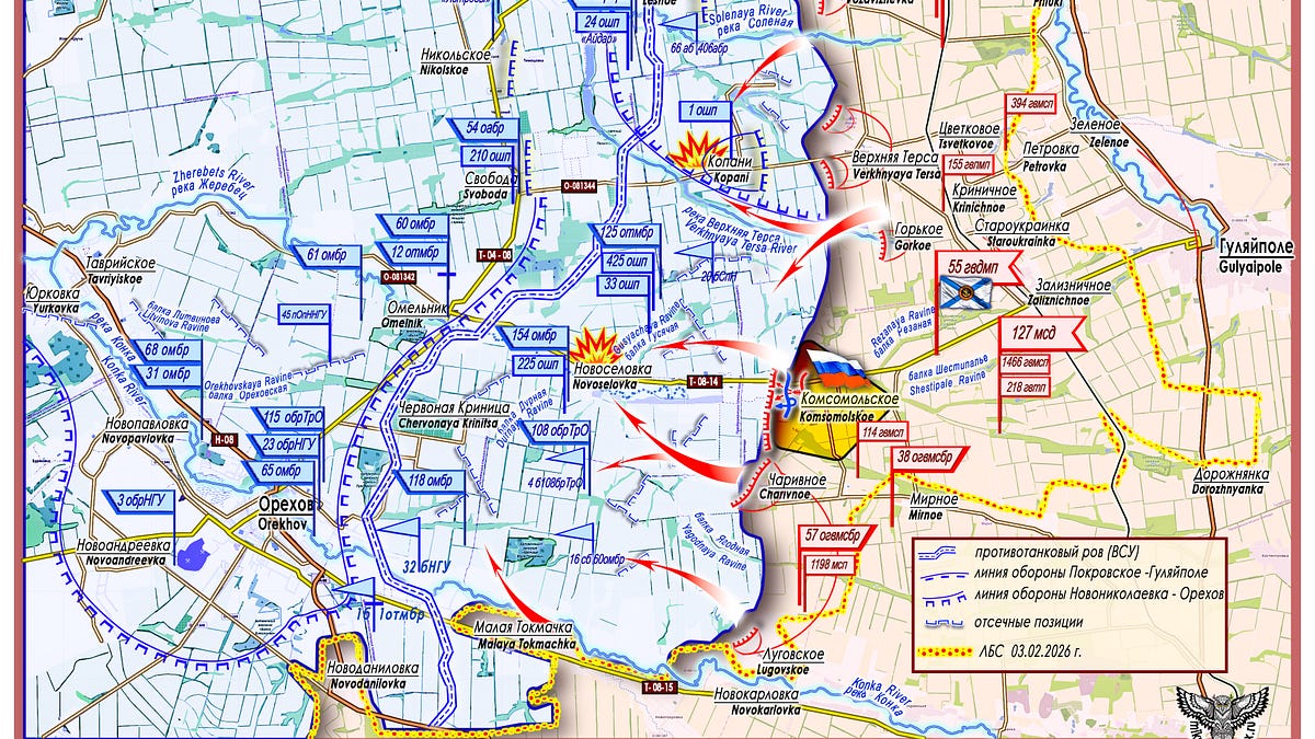
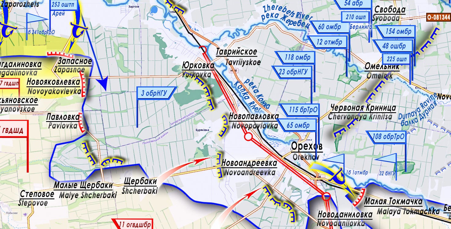
East Group Area of Responsibility; The two solid blue lines with blue dashes between them represent the Anti-Tank ditch in front of Orekhov. The single solid blue line with blue dashes running parallel to it represents the Pokrovskoe-Gulyaipole defense line. The blue arches running along a solid blue line represent the Novonikolaevka to Orekhov defense line. Where you see blue arches facing alternating directions, that represents blocking positions of the AFU. The yellow line with red dots is the line of combat contact as of February 3rd, 2026.
[

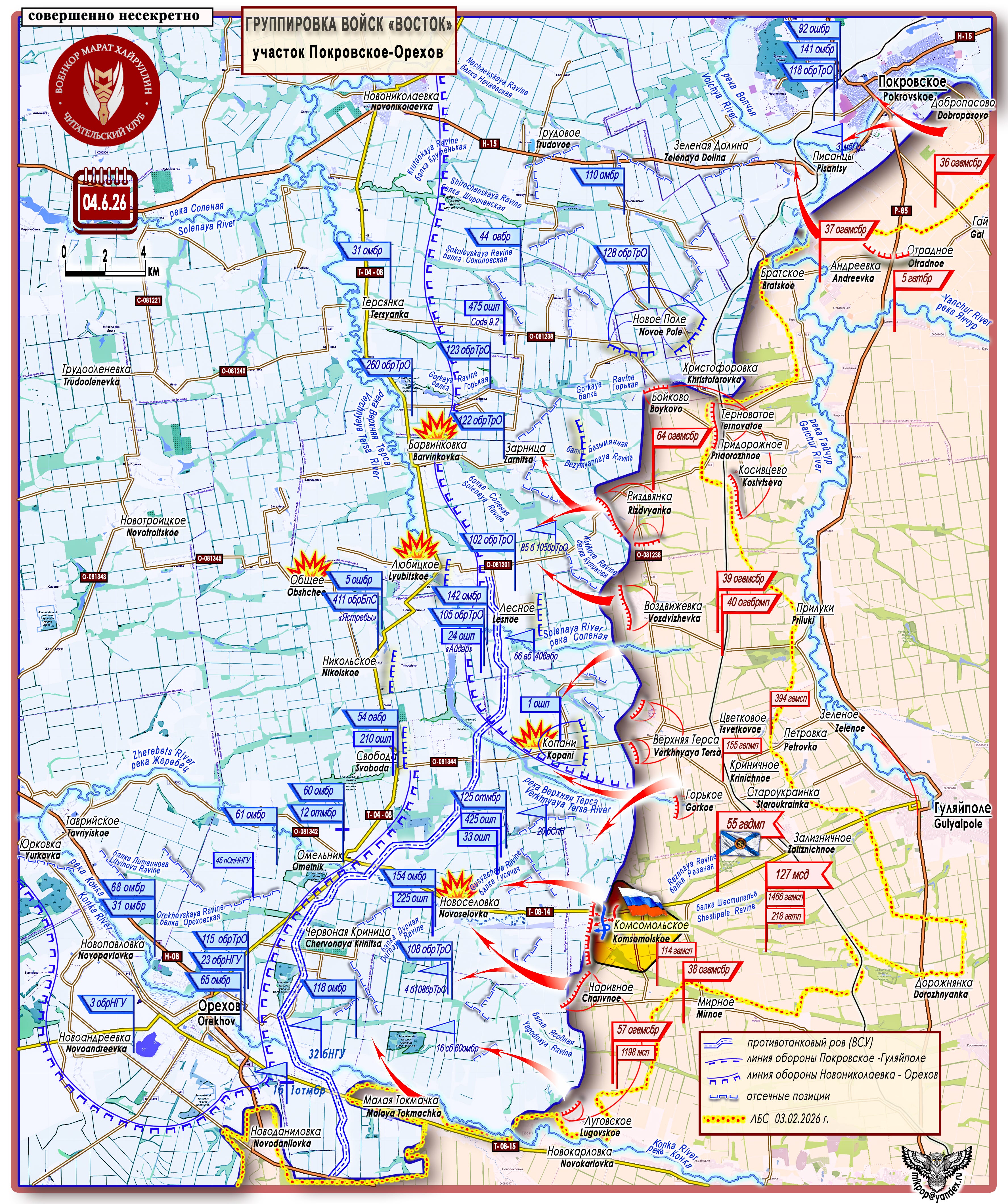
Zaporozhye Direction (Zaporozhye-Pokrovskoe-Orekhov)
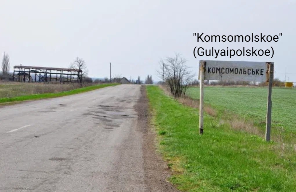
Message from the Russian Ministry of Defense: "Servicemen of the 114th Guards Motorized Rifle Regiment of the 127th Motorized Rifle Division of the 5th Combined Arms Army of the ‘East’ Group have taken control of a large and important enemy defensive hub – Komsomolskoe (Gulyaipolskoe) in Zaporozhye Oblast. During prolonged battles, the motorized riflemen cleared a defense area of up to 5 square kilometers, taking control of over 250 buildings."
The “East” Group, like a powerful steamroller, is relentlessly and persistently crushing the Nazi scum in Zaporozhye Oblast.
On June 4, the settlement of Komsomolskoe (47°36′46″ N 36°03′43″ E, since 2016 – Gulyaipolskoe, population 1,058 in 2001) was taken under control. This is one of the nodal areas of the Ukrainian Armed Forces’ Gaichur defensive line in Zaporozhye Oblast, which ran along the watershed ridge of the Gaichur and Verkhnyaya Tersa rivers, relying on the railway line laid along the highest elevations. With the transfer of the settlement of Komsomolskoe under the control of the Russian army, it can be stated that the Gaichur defensive line of the Ukrainian Armed Forces has been destroyed. Prior to this, the Yanchur River and Velikaya Novoselka(along the Mokrye Yaly River) defensive lines of the enemy were overcome, along with the spaces between them, filled with pre-prepared blocking positions, pre-sighted concentrated fire zones, and fire pocket areas into which the enemy attempted to draw advancing Russian Armed Forces units. On a broad front, with alternating breakthroughs on individual sectors using outflanking maneuvers, the “East” Group is destroying and pushing the enemy to the Novonikolaevka - Orekhov line, “tightening the noose around the neck” of the well-fortified Ukrainian Armed Forces’ defensive hub of Orekhov - Omelnik - Tavriyskoe. Here was one of the base areas of the so-called “counter-oink” – the counteroffensive of 2023 by the Ukrainian “Tavria” group. This operational space is located in river valleys that flow in both latitudinal and longitudinal directions, with a developed road network. It was prepared in every respect and saturated with combat-capable formations.
[

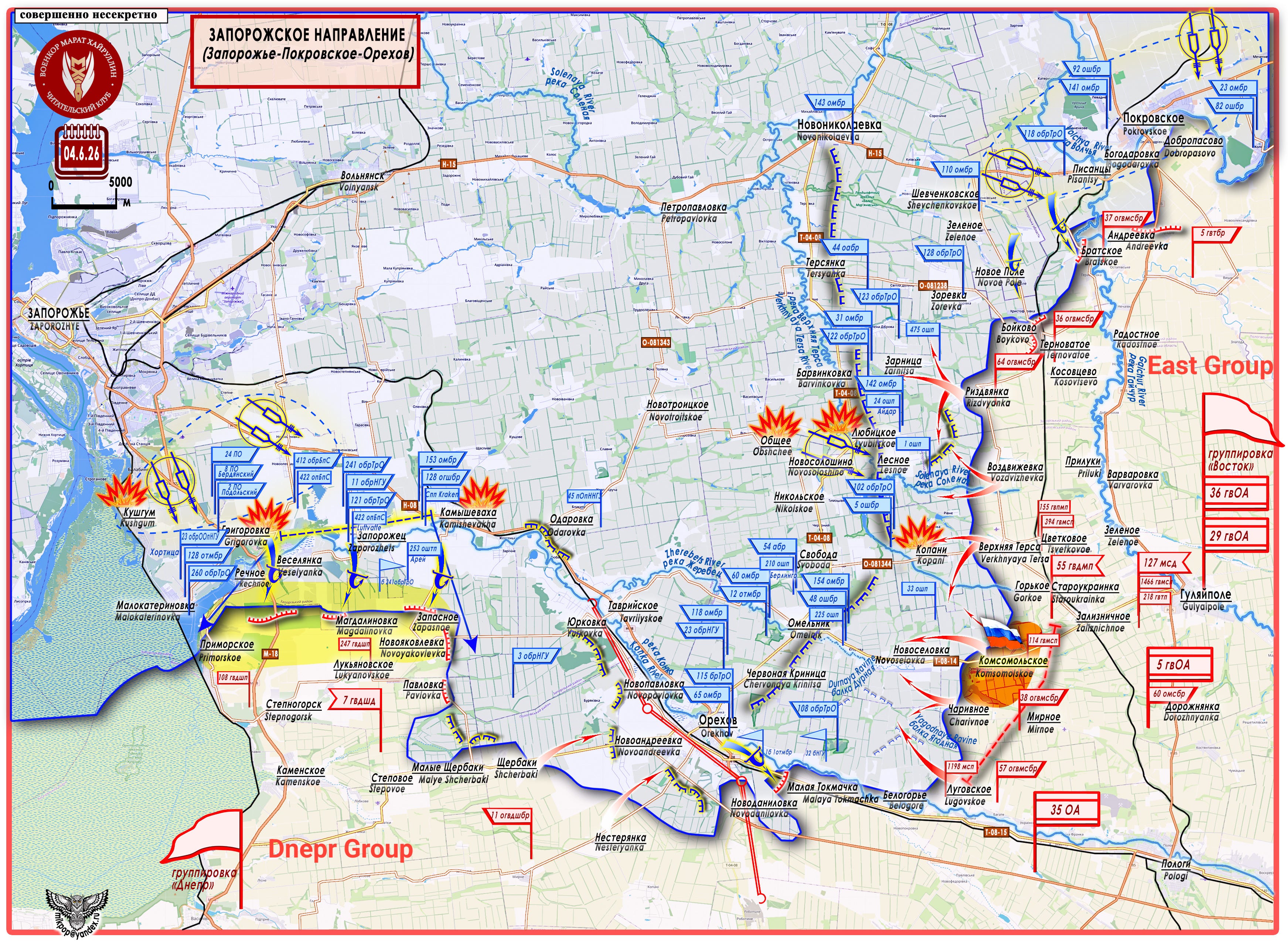
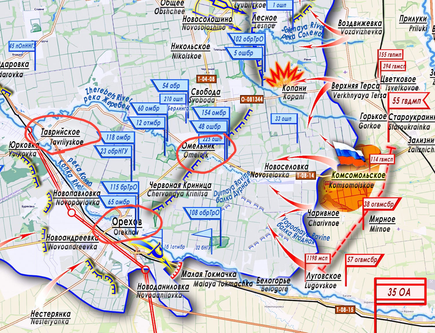
After reaching the Komsomolskoe area, units of the “East” Group have taken initial positions for further advance on a very advantageous section of terrain: with heights on the flanks and a lowland in the center. The right flank: the Gorkoe (elevation 151 m) - Svoboda (147 m) axis. The left flank: the Charivnoe (125 m) - Chervonaya Krinitsa (117 m) axis. These are flanks with axes along the high ground. The center: Komsomolskoe (83 m) - Omelnik (53 m), along the T-08-14 highway, through the valley of the headwaters of the Zherebets River.
In the near future, activation is likely on the Malaya Tokmachka - Novodanilovka (south of Orekhov) and Novoyakovlevka - Yurkovka (west of Orekhov) axes.
[

[
